import { GLOBALCONFIG } from '@/config';
import { loadModules } from 'esri-loader';
type MapModules1 = [typeof import('esri/tasks/QueryTask'), typeof import('esri/tasks/query'), typeof import('esri/graphic'), typeof import('esri/symbols/SimpleFillSymbol'), typeof import('esri/tasks/GeometryService'), typeof import('esri/geometry/Polygon'), typeof import('esri/tasks/AreasAndLengthsParameters'), typeof import('esri/symbols/SimpleLineSymbol'), typeof import('esri/Color')];

interface Options {
    url: string;
    map: import('esri/map');

    layerIds: number[];
    geometry?: any;
}

export const query = async (options: Options) => {
    return new Promise(async (resolve, reject) => {
        try {
            const { url, map, layerIds, geometry } = options;

            const mapRes = await loadModules(['esri/tasks/QueryTask', 'esri/tasks/query', 'esri/graphic', 'esri/symbols/SimpleFillSymbol', 'esri/tasks/GeometryService', 'esri/geometry/Polygon', 'esri/tasks/AreasAndLengthsParameters', 'esri/symbols/SimpleLineSymbol', 'esri/Color'], { url: `${GLOBALCONFIG.BASEGIS.APIHOST}/dojo/dojo.js` });
            const [QueryTask, Query, Graphic, SimpleFillSymbol, GeometryService, Polygon, AreasAndLengthsParameters, SimpleLineSymbol, Color] = mapRes as MapModules1;
            const urls = window.lv.url + '/' + window.lv.layerIds[0];
            const queryTask = new QueryTask(urls);
            const query = new Query();
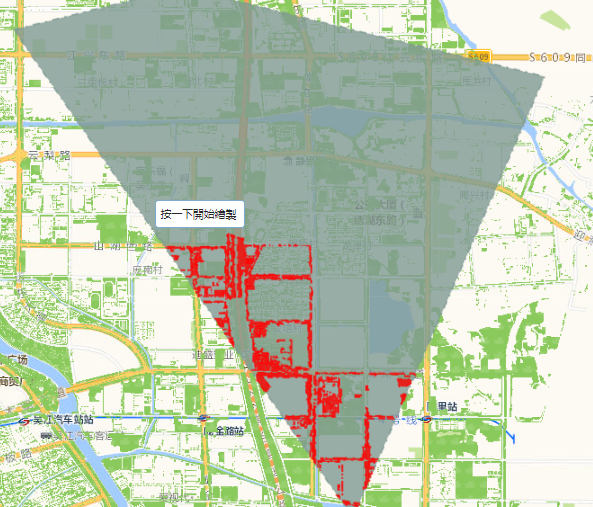
            //空间查询的几何对象
            query.geometry = geometry;
            //服务器给我们返回的字段信息,*代表返回所有字段
            query.outFields = ['*'];
            //空间参考信息
            query.outSpatialReference = map.spatialReference;
            //query.outSpatialReference = _this.props.mapControl.map.spatialReference;
            //查询的标准,此处代表和geometry相交的图形都要返回
            query.spatialRelationship = Query.SPATIAL_REL_INTERSECTS;
            //是否返回几何信息
            query.returnGeometry = true;
            const result1 = await queryTask.execute(query);
            if (result1 && result1.features.length === 0) {
                resolve(0);
                return;
            }
            const geometryService = new GeometryService(GLOBALCONFIG.BASEGIS.GEOMETRYSERVICE);
            const geometries = result1.features.map((item: any) => item.geometry);

            const result = await geometryService.intersect(geometries, geometry);

            const uniRes = await geometryService.union(result);
            const areaRes: any = await distancePolygon(map, uniRes);
            const symbol1 = new SimpleFillSymbol(SimpleFillSymbol.STYLE_SOLID, new SimpleLineSymbol(SimpleLineSymbol.STYLE_DASHDOT, new Color([255, 0, 0, 0.8]), 2), new Color([255, 0, 0, 0.8]));
            var graphic = new Graphic(uniRes, symbol1);
            //_this.props.mapControl.map.graphics.add(graphic);
            map.graphics.add(graphic);
            if (areaRes && areaRes.result && areaRes.result.areas) {
                resolve(Number(areaRes.result.areas));
            } else {
                reject(0);
            }

            resolve(result1);
        } catch (e) {
            reject(e);
        }
    });
};

export const distancePolygon = async (map: any, geometry: any) => {
    return new Promise(async (resolve, reject) => {
        const result = await loadModules(['esri/tasks/GeometryService', 'esri/tasks/AreasAndLengthsParameters'], { url: `${GLOBALCONFIG.BASEGIS.APIHOST}/dojo/dojo.js` });
        const [GeometryService, AreasAndLengthsParameters] = result;
        let geometryService = new GeometryService(GLOBALCONFIG.BASEGIS.GEOMETRYSERVICE);

        const areasAndLengthParams = new AreasAndLengthsParameters();
        areasAndLengthParams.lengthUnit = GeometryService.UNIT_FOOT;
        areasAndLengthParams.areaUnit = GeometryService.UNIT_SQUARE_METERS;
        areasAndLengthParams.calculationType = 'preserveShape';
        geometryService.simplify([geometry], function (simplifiedGeometries: any) {
            areasAndLengthParams.polygons = simplifiedGeometries;
            geometryService.areasAndLengths(areasAndLengthParams);
        });
        geometryService.on('areas-and-lengths-complete', (d: any) => {
            resolve(d);
        });
    });
};
文章版权声明:除非注明,否则均为
譬如朝露_策温技术开发工作室博客原创文章,转载或复制请以超链接形式并注明出处。


发表评论
侧栏公告
寄语
譬如朝露博客是一个分享前端知识的网站,联系方式11523518。
热评文章
标签列表
热门文章
友情链接