<!DOCTYPE html>
<html lang="en">

<head>
    <meta charset="UTF-8">
    <meta http-equiv="X-UA-Compatible" content="IE=edge">
    <meta name="viewport" content="width=device-width, initial-scale=1.0">
    <title>等值线 等值面 GP 调用 demo</title>
    <link rel="stylesheet" href="http://xxxx/arcgis_js_api/library/4.20/esri/themes/light/main.css">
    <script src="http://xxxx/arcgis_js_api/library/4.20/init.js"></script>
</head>
<style>
    html,
    body {
        width: 100%;
        height: 100vh;
        padding: 0;
        margin: 0;
    }
    #mapDiv{
        width: 100%;
        height: 100vh;
    }
</style>

<body>
    <div id='mapDiv'></div>
</body>
<script>
    let dzdtUrl = "http://xxxx/arcgis/rest/services/BaseMap/BlueMap2019_2000/MapServer";
    require(["esri/Map",
    "esri/views/MapView",
    "esri/geometry/SpatialReference",
    "esri/layers/MapImageLayer",
    "esri/layers/GraphicsLayer",
    "esri/geometry/Point",
    "esri/Graphic",
    "esri/rest/support/FeatureSet",
    "esri/tasks/Geoprocessor",
    "esri/symbols/SimpleLineSymbol",
    "esri/Color"],
    function(Map, MapView,SpatialReference,MapImageLayer,GraphicsLayer, Point, Graphic,FeatureSet,
    Geoprocessor,SimpleLineSymbol,Color){
        let tiledLayerDZDT = new MapImageLayer(dzdtUrl, { id: '电子地图' });
        let map = new Map({
            layers: [tiledLayerDZDT]
        });
        let view = new MapView({
            container: "mapDiv",
            map: map
        });

        let gp = new Geoprocessor("http://xxxx/arcgis/rest/services/WJWATER/Model_dengzhixian/GPServer/Model_dengzhixian");

        let graphicLayer = new GraphicsLayer({id:"dengzhixian"});

        let markerSymbol = {
            type: "simple-marker",
            color: [ 255,0,0,0.5],
            outline: {
                color: [ 255,255,255,1],
                width: "0.5px"
            }
        };
        let baseSpatialRef = new SpatialReference(4490);

        //模拟测站点数据
        let graphic1 = new Graphic(new Point(120.65150200000005,30.925711000000035,baseSpatialRef),markerSymbol,{"OBJECTID": 1,"stcd": "1","stnm": "盛泽","drp": 330,"x": 120.651502,"y": 30.925711});
        let graphic2 = new Graphic(new Point(120.50056400000005,30.828365000000076,baseSpatialRef),markerSymbol,{"OBJECTID": 2,"stcd": "2","stnm": "桃源","drp": 210,"x": 120.500564,"y": 30.828365});
        let graphic3 = new Graphic(new Point(120.64674500000001,31.163235000000043,baseSpatialRef),markerSymbol,{"OBJECTID": 3,"stcd": "20","stnm": "松陵内河(西门二站)","drp": 320,"x": 120.646745,"y": 31.163235});
        let graphic4 = new Graphic(new Point(120.66083700000001,31.155732000000057,baseSpatialRef),markerSymbol,{"OBJECTID": 4,"stcd": "21","stnm": "松陵外河(运河)","drp": 590,"x": 120.660837,"y": 31.155732});
        let graphic5 = new Graphic(new Point(120.59381200000007,31.134543000000065,baseSpatialRef),markerSymbol,{"OBJECTID": 5,"stcd": "22","stnm": "东太湖","drp": 70,"x": 120.593812,"y": 31.134543});
        let graphic6 = new Graphic(new Point(120.55207700000005,31.025490000000048,baseSpatialRef),markerSymbol,{"OBJECTID": 6,"stcd": "23","stnm": "开发区","drp": 510,"x": 120.552077,"y": 31.02549});
        let graphic7 = new Graphic(new Point(120.55207700000005,31.025490000000048,baseSpatialRef),markerSymbol,{"OBJECTID": 7,"stcd": "23","stnm": "横扇","drp": 300,"x": 120.552077,"y": 31.02549});
        let graphic8 = new Graphic(new Point(120.67094400000008,31.106012000000078,baseSpatialRef),markerSymbol,{"OBJECTID": 8,"stcd": "3519","stnm": "南大港闸站","drp": 540,"x": 120.670944,"y": 31.106012});

        //用于比对效果
        graphicLayer.add(graphic1);
        graphicLayer.add(graphic2);
        graphicLayer.add(graphic3);
        graphicLayer.add(graphic4);
        graphicLayer.add(graphic5);
        graphicLayer.add(graphic6);
        graphicLayer.add(graphic7);
        graphicLayer.add(graphic8);

        map.layers.push(graphicLayer);
        //用于生成等值线的参数
        let features = [];
        features.push(graphic1);
        features.push(graphic2);
        features.push(graphic3);
        features.push(graphic4);
        features.push(graphic5);
        features.push(graphic6);
        features.push(graphic7);
        features.push(graphic8);

        let featureset = new FeatureSet();
        featureset.features = features;
        let para = {
            YL_point:featureset,
        }


        let slsymbol = new SimpleLineSymbol(//标识等值线的渲染
                SimpleLineSymbol.STYLE_DASH,
                new Color([255,0,0]),3
        );
        gp.submitJob(para).then(jobInfo => {
            gp.waitForJobCompletion(jobInfo.jobId, { interval: 3000 }).then(jobInfo => {
                gp.getResultData(jobInfo.jobId, "Contour_Idw_YL_1").then(response => {
                    console.log(response);
                    let features = response.value.features;
                    features.forEach(
                        function(item,index,arr){
                            console.log("item",item,"index",index,"arr",arr);
                        });
                });
            });
        });
    });
</script>
</html>正文
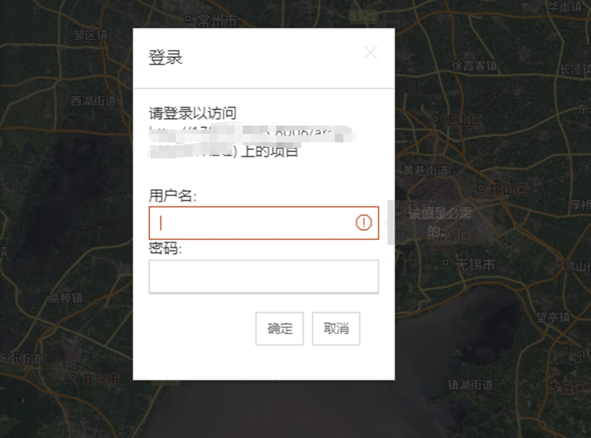
arcgis api 4.20请求GP服务
文章版权声明:除非注明,否则均为
譬如朝露_策温技术开发工作室博客原创文章,转载或复制请以超链接形式并注明出处。


发表评论
侧栏公告
寄语
譬如朝露博客是一个分享前端知识的网站,联系方式11523518。
热评文章
标签列表
热门文章
友情链接